Set alarm on watch for 5am but, shamefully, was next aware of Margaret with a cup of tea rather later.
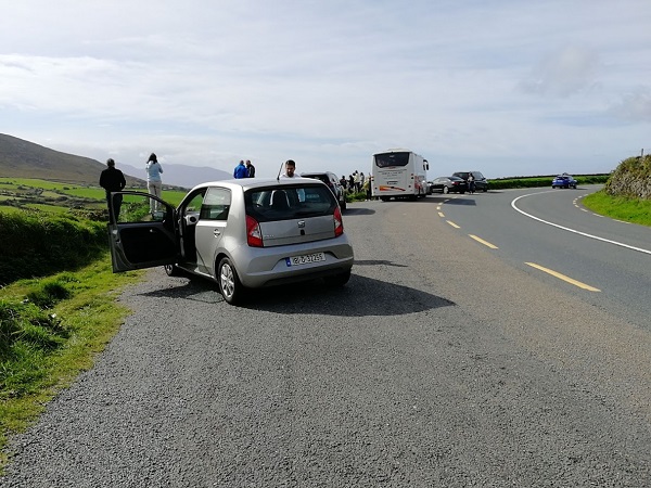
After breakfast, I loaded the bike into David’s car and set off towards the docks, a journey that I had expected I would be making on my bike, and I increasingly realised what an unpleasant and confusing journey it would have been, made worse by the dismal morning. After working though rather more streets than I had expected we crossed into the commercial dock area with long bleak roadways and plenty of lorries.
The problem with taking a bike on a ferry is that you are sometimes classified as a pedestrian and sometimes a vehicle, despite the cycle storage invariably being on the vehicle deck where you lash your bike securely to racking along the the side of the hull.
If you are classified as a vehicle you follow the vehicle lanes and collect your documents from one of the booths. My grandson Mikey and I have often used the Harwich Ferry to Holland and quickly discovered that the safest way is to act like a vehicle and ride right in the middle of the vehicle lane, often with a large lorry in front and one behind. At Fishguard I had been classified as a bicycle with a separate entrance and allowed onto the boat when the vehicles had been loaded.
David dropped me outside the main reception to pick up my ticket and, when the boat was due to load, I was able to slip through a small gap into the vehicle area to load through the rear ramp. I chose to pay a supplement for the lounge, segregated from the hurly-burly, with my own table to work at and free hot and cold drinks. There was also free red and white wine, which interestingly, few passengers availed themselves of; the red was pleasant. Sailed out of Dublin Harbour with so many happy memories to recall.
I had wanted to postpone booking my train back across Ireland and also the ferry journey via what was described in Ireland as “The Celtic Sea” from Dublin to the mainland, until after I had arrived at the furthest point west and could be certain how many days it would take to cycle to the railhead at Tralee. I then discovered that a potential problem was that for part of the journey I would have to reserve a place for my cycle well in advance as the number of places available on each train was limited. When I was at Killarney I booked the train from Tralee, leaving an extra day spare in case I needed it which, unexpectedly, turned out to be a sensible decision.
I had intended to take the night ferry to Liverpool, having previously used that service from Liverpool some years before. It was a vehicle ferry and the price included a shared cabin and an unlimited breakfast with the type of food that lorry drivers would like. I tried to book online but found that this was impossible as you had to book a vehicle at the same time and a bicycle did not count as a vehicle. I telephoned the ferry booking office but they refused to accept a booking for a bike. The result was that I now had to stay overnight in Dublin because the train I had booked from Tralee did not arrive until the middle of the day. Subsequently, I remembered that, last time, I had booked my bike as a motorcycle!
I arranged with my helpful host to leave my cycle at the B&B until I needed it later. I had to pick up my ticket from the station so went first to collect it in case of last-minute problems. I also needed a battery for my watch which had given up a few days before. One of the pleasures of the ride was that time had seemed irrelevant but, sadly, I was now back in the real world.
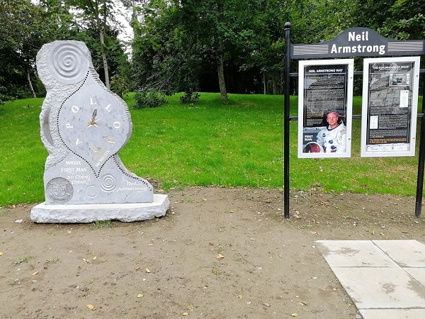
I asked my host for directions to the station which turned out to be through the maze of streets in the centre of the town. Sensing my confusion, my host pointed out a very tall church spire and said that if I aimed for that it would take me to the station. So, instead of going down the main road, l crossed it and was immediately in a park and heading along Neil Armstrong Way and soon passed a sculpture commemorating Neil Armstrong’s visit on the 18th April 1997 to open the Kerry County Museum Exploration of Space exhibition. After Neil Armstrong‘s death, it was decided to create the pathway to the museum to commemorate his visit, and the sculpture with an exhibition board had been moved there. (see photo at top of post). After passing the modern looking Museum and the rest of the park, I threaded my way through the attractive streets in the centre of Tralee aiming at the spire which, it turned out, overlooked the station.
I then searched for a shop to change the battery. Neither of the two watch shops could remove and replace the sealed back of my sports watch but both directed me to a watchmaker who they said would certainly be able to do it. I tracked him down in a small shop and he said that he had the appropriate battery and would do it straightaway. It was a fiddly job and there followed another of those moments when we sat and philosophised about the pleasures of Ireland. He would not take anything for the work which he said he had enjoyed doing for me.
The pattern of ferries to Holyhead involved main ferries early in the morning and the evening, and a fast ferry in the middle of the day. I had arranged to stay with friends in Chester who had invited me to pop in if I was in the area. When I found that I would have to be returning via Holyhead, I booked on the midday ferry.
The train journey turned to be as beautiful as I had hoped. The route headed south towards Killarney past the hills and then west to Mallow (where I had cycled on my way across Ireland), to connect to the Cork – Dublin line. I passed near a number of places I was familiar with including the level crossing at Rathmore where I had had a long wait. I was slightly worried about the connection to the Cork -Dublin line as there was not much leeway in the time shown but the train was waiting and the connection seemed quite a social occasion between the train staff, travellers and relations. Soon after leaving Mallow, to my surprise, I received a message on my mobile phone. It was bad news from Stena Ferries: it was likely that tomorrow’s midday ferry would be cancelled
because of bad weather and I was advised to rebook onto the early morning or evening ferry. I would now have to catch the morning ferry or else I would be stuck in Holyhead all night.
I had been looking forward to my overnight stay in Dublin and a leisurely start next morning which had fortuitously been arranged for me. I had been due to represent Britain in my 80 to 85 age group at the European Championships at Ibiza in the Sprint Duathlon in October. However, I thought that I had no possibility of being fit enough for an international by then so had informed British Triathlon who had then told the team captain, Joan Lennon, who I had got to know well at previous internationals and had great respect for. She had been in touch to say how sorry she was and, when I sent her a link to this blog, she emailed me to say that her family in Ireland would be more than happy to put me up for the night and that her sister Margaret and husband David lived
in Dublin. I telephoned them and, when I explained the circumstances, Margaret replied enthusiastically that they would certainly put me up and would enjoy hearing about my travels. She gave me directions to cycle from the station to their house which
was in easy cycling distance so I would have plenty of time in the morning to cycle
from there to catch my midday ferry.
On arrival at Hueston Station in Dublin, I set off to the address which was in a residential area on the other side of the centre and found myself in the evening commuter traffic heading along the Quays. I recognised a bridge where I had once stood trying to cross the road and watched the heavy traffic with amazement; I was now in it! I found, as in London, it is not as bad as it looks when you are part of it and there were not the adrenaline charged cyclists jumping the lights as there are in London, they were far more courteous. I heard a bus behind me hoot but I dared not take my eyes of the road ahead. It hooted again and then pulled alongside, slowed down and the driver leaned out to point out that the strap holding my baggage had come loose – it could have got in my wheel and brought me off into the traffic.
Getting out of the centre, I started worriedly rehearsing what I would say about my early start and as soon as I got into the house I unburdened myself. Perhaps recognising my anxiety, David said with a smile, “Don’t worry I will drive you to the Docks and will wake you up at 5 o’clock”. What a relief!
A scrumptious meal was already waiting and we spent much of the evening chatting about a variety of interesting Irish and British subjects, but avoided Brexit. Margaret and David had the same relaxed and friendly manner as Joan and I felt really at home.
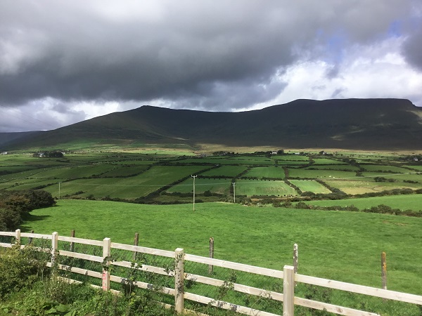
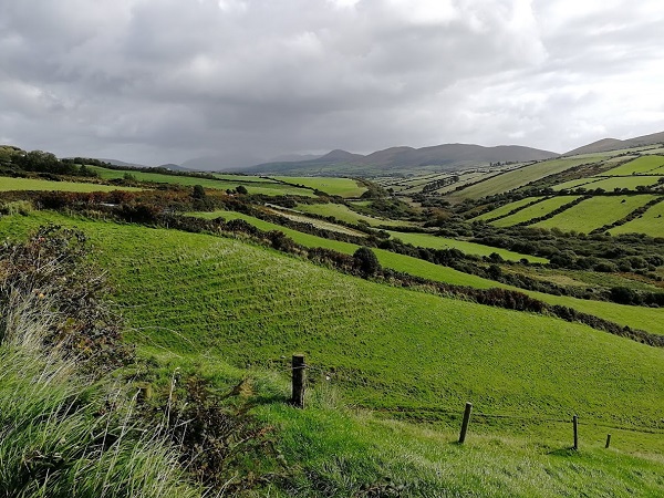
Woke up feeling very relaxed as it was an easy ride today which started by returning along the main road to Annascaul, then over the spine of the Peninsula to the North coast picking up the main road to Tralee, the capital of Kerry. This is an easier route than the Connor Pass but still promises some undulating climbs which I was quite looking forward to as my last challenge.
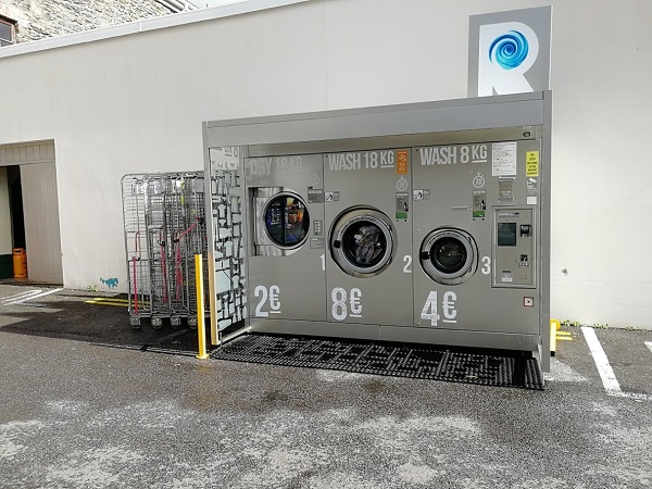
Firstly, I had a final look around Dingle and came across these useful washing machines at the rear of the supermarket.
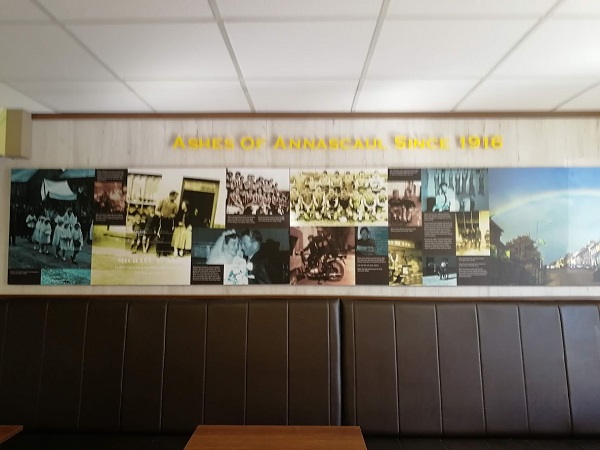
Although I had already ridden the next few miles before, it seemed quite different because I was now seeing the countryside, hills and horizon from the opposite angle. A difficult, winding, narrow part of the road had been replaced by a new road with a mile long cycle path. It was a pleasure to ride into Annascaul again, where I had received such a good welcome and a lot of help wherever I went. Near the South Pole Inn I went into the local shop and saw that they had a few tables on one side so I had a coffee and a bun and bought a newspaper to read. This shop had been in the Ashes family since 1916 and there was an intriguing display of photographs on the wall showing some of the history of the family, shop and High Street since then.
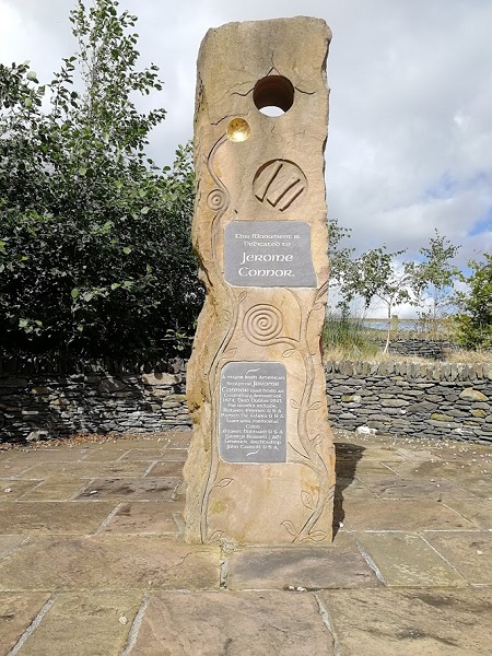
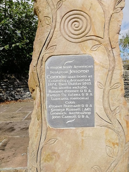
Annascaul’s sense of history continued with a sculpture commemorating Jerome Connor, born here in 1874, dying in Dublin in 1943. In 1888 Jerome, whose father had been a stonemason, emigrated to Massachusetts with his family and became a major Irish American sculptor whose most famous work was probably Nuns of the Battlefield standing in Washington D C, a tribute to more than 600 nuns who nursed soldiers from both sides in the American Civil War. In 1925, Jerome returned and set up his own studio in Dublin and, among many other works, created the poignant Lusitania Memorial in Cobn, the last stop where many passengers embarked the Cunard liner. The ship was sunk soon after leaving the harbour and included in the monument were the figures of two fishermen showing their emotion after picking up survivors and the drowned.
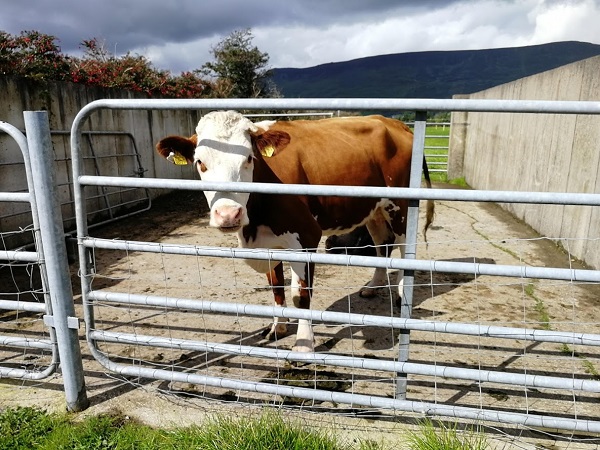
Cycling up the road, there were only sheep in the fields but I came across a single milking cow and we stared at each other for a couple of minutes in mutual
incomprehension. I started climbing the pass, and the hills to the north were made more spectacular by the overhanging clouds.
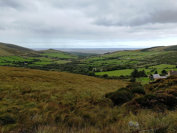
I had earlier donned my light, running, visibility wind proof which had protected me from the mist and drizzle. At the summit I stopped to view the scene ahead and remembered looking at an almost identical scene 15 cycling days beforehand, seeing the sea in the distance knowing that it was downhill all the way to the railhead at Fishguard where I would be catching the train home. Rain started to fall and, as I knew I had a long downhill ahead, I put my rain jacket on. The rain stopped halfway down and, as I took off the jacket again, I looked upwards and saw that it was still falling on the higher slopes.
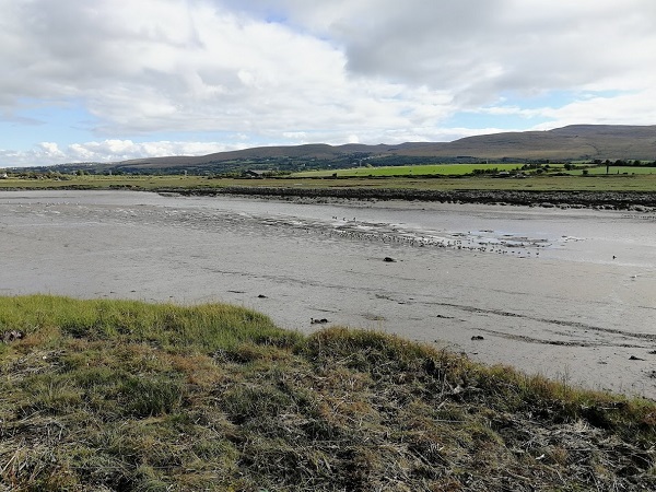
It was a scenic ride into the town with the shore on one side and, later, the Tralee Bay wetlands on the other. I also passed a lake by the road with waders feeding on the mud. Behind, more extensive reed beds became visible and then I passed the entrance to the main wetlands with directions to the main water channels and reed beds with pedal boats, cafe and observation towers. There was a notice advertising guided tours. Fortunately, I had no difficulty finding my Bed and Breakfast as it was on the way in but still a convenient walking distance to the centre of the town.
I received a great welcome and care was taken to ensure that my bike was properly secured under cover. After settling in, I headed into town to the restaurant recommended by my helpful host, to find that it was so popular that there was a queue for tables. I tried my sometimes successful trick of walking inside to see if I could spot a place on a counter or end of the bar where I could sit and eat, but without success, and was told it would be 20 minutes to half an hour before a table would be available. It looked very attractive inside with happy diners and the food on the tables looked delicious. At it was the first place I had come to and, by then, it seemed a long time since I had eaten, I decided to look around the town. There were the usual places to eat,
MacDonalds etc. but I wanted somewhere Irish but did not find anywhere until I was back near the restaurant again and saw a pub almost deserted and which served traditional food in a separate restaurant area. I checked the first restaurant again but there are still a long queue so returned to the quiet pub.
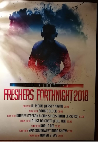
The pub had a large standing area and it seemed strange that it was so empty, particularly as it was clear from the number of beer pumps that they were set up for large numbers of customer. I spotted a poster advertising FRESHERS FORTHNIGHT with a list of gigs which were being held at the pub but none that night – 12th. I mentioned to the barman that it seemed very quiet and he said they were not so busy this year, and that the students now bought cheap cans of beer from the supermarket, which they drank first, and did not buy much in the pub. It had been interesting to have just read in the newspaper that the proportion of students that did not drink alcohol at all
had been increasing year by year and was now about 25%. The Irish stew was good.
I walked back through the town and it had seemed very quiet without any sign of students. I returned to the bed and Breakfast realising that my cycling tour was now over but anticipating an interesting journey looking at the countryside on the train I would soon be taking right across Ireland to Dublin on the East coast.
The next morning, Michael and I stood in the lounge looking at the splendid view over the bay to the Blasket Islands and discussed local life and history. I was leaving De Morda with some regret. In the lounge, the local books included more in which Michael had been involved including one diary by an inhabitant of the Islands that was written in Irish but with Michael’s translation on the facing page; the islanders had all been native Irish speakers.
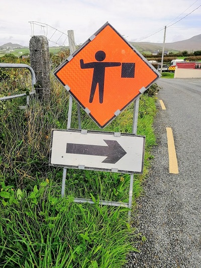
Soon after leaving, I came across another pictorial sign along the road and discovered that it meant that there were roadworks along the lane leading off to the right.
In about a mile I turned down the drive into the car park of the Blasket Centre which was large, with plenty of room for coaches. The Heritage Centre was an impressively designed building, low to fit into the landscape. The atrium was large, light and airy and led to a museum, book shop and a theatre which could hold 100 people. About every half an hour there was a very interesting presentation telling the history of the community, their struggle for existence, their own language and culture and modes of life and work until they were evacuated in 1953. Some of the introduction was by Michael who was manager there after its opening in 1993.
There was also “The American Room.” As the harsh conditions became less tolerable in a more modern society, the inhabitants gradually left the Islands with many emigrating to Springfield, Massachusetts, family members welcoming the newcomers as they arrived. The population had been completely Irish-speaking, the school on the Island closed and the children were educated on the mainland. The reduction in the population resulted in the gradual loss of amenities but there was a further problem: Great Blasket Island was often cut off by bad weather, as it still can be. The islanders’ requests to government for help over a number of years to keep their community viable were not met. Eventually, public opinion forced them to act when one of the children contracted meningitis but the Island was cut off by storms and when help arrived, after three weeks, it was too late. The islanders were settled on the mainland and, since then, the Islands have remained uninhabited.
A term popular with the American migrants for the Blasket Islands was “Next Parish -America”. Their descendants are now visiting the Centre to discover what the GoKerry web site describes as “their history and the effects of emigration of the rural communities in Kerry”. There are exhibitions on the daily life, traditional fishing and farming methods, the Irish language and Blasket literature. There are “Interactive features to feel, listen and experience the sounds, images and elements of the islander’s way of life”. There is also a large educational area for children and school visits. The GoKerry web site also describes the Centre as being one of the two Kerry Signature Points on the Wild Atlantic Way and the half way point of the Slea Head Drive.
Leading from the Atrium there was an airy passage to a large cafe/ restaurant which, with the large and spotlessly clean toilets, would be welcomed by the coach passengers.
I took a picture across the fields showing the Great Blasket Island and Dunmore Head and set off on my way back, continuing along the Slea Head Drive to Dingle. Passing though Ballyferriter, now it was daylight, I could see that is was the local administrative and shopping centre for the area. Target completed, I was now cycling with a feeling of carefree freedom. It was less than 30 miles to Dingle and I was now heading towards Gallarus Oratory, one of the most famous historical sites in Dingle Peninsula. I had been urged a number of times beforehand not to miss it.
Shortly after I left Ballyferriter I suddenly came across the West Kerry Brewery. There was a reference to a shop and Brewery Tours and, as I could see no one about but the doors were open, I took this as an invitation and found myself wandering around the Brewery and shop. It was all very interesting and then someone appeared from a side door and seemed surprised to see me. When I told him that I had enjoyed one of his beers the previous night I was welcomed but had to explain that I could not buy any bottles as I was cycling.
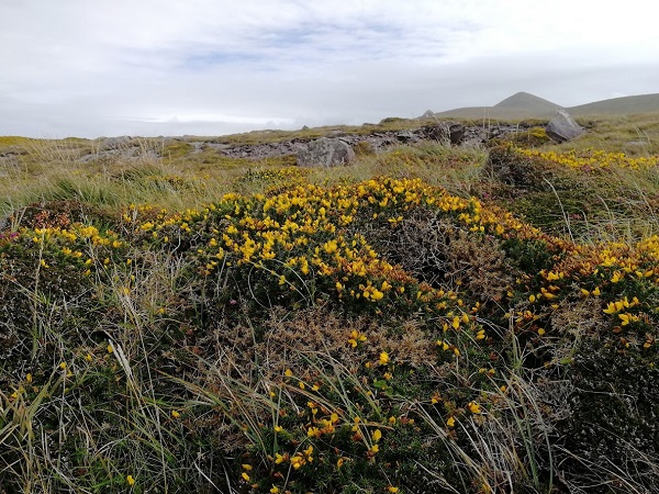
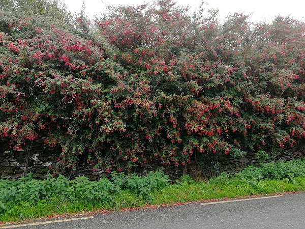
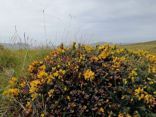
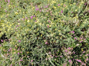
The scenery was spectacular and the roadsides wild. The further west I had gone, the more the hedgerows had been taken over by fuchsia. I assumed that it was a native plant but was told that it was an introduction from several hundred years ago. The bush in my garden is a pale imitation but the soil and climate in Kerry suits it and it was suggested that it also likes the saltiness borne on the west wind. There were also gorse bushes so I took a photograph of one to remind me of my prickly encounter with a low bush on Dunmore Head.
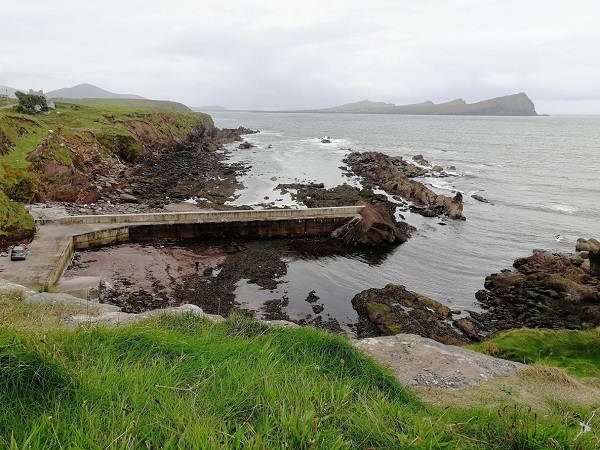
I was reluctant to leave the picturesque countryside and continued past my turn to ride along a bay until I reached what seemed to be an abandoned harbour. However, when taking a photograph, I saw rain showers approaching from the west.
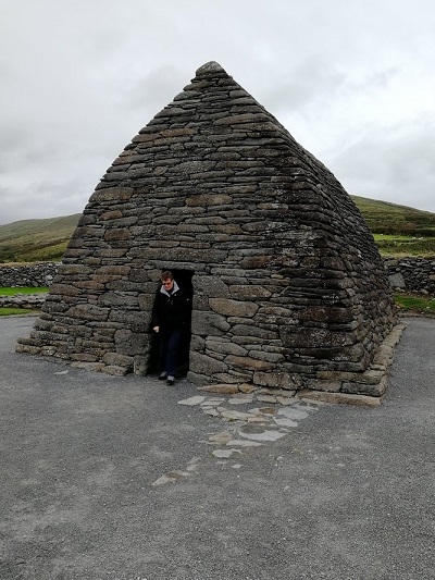
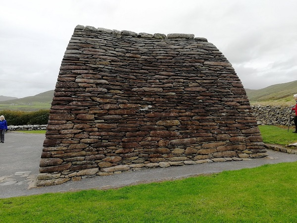
I hurried off to the Oratory and went into the cafe for shelter and tea and cake. There was also an exhibition, a gift shop and a separate room to watch a video of the history of the Oratory and surrounding area. After looking at these, the showers had passed so I went to look at the Oratory itself. The Oratory was a few hundreds yards away from the Visitor Centre from which it was hidden to protect its remote setting. It was built between the seventh and eighth century and is the best preserved early Christian church in Ireland. What is really striking is its construction using techniques first developed by Neolithic tomb makers and also used in the beehive huts I had passed a few days before. The stones are laid slightly sloping so that the rain runs off them and there is just one small window at the rear so inside it is dark. The Guide said that it had never had to be restored.
Set off again for Dingle, and could soon see the road winding up the first of the hills forming the spine of the Peninsular. I stopped to look at it with pleasurable anticipation and remembered the apprehension I had had on my first day struggling up not very steep hills towards the Severn Bridge and having to get off and push after the first few miles. Now the hills were an enjoyable challenge; I could not remember when I had last had to push and I had my cyclist thighs back again.
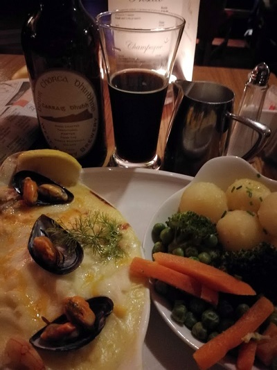
There was a long Scenic downhill to Dingle as Dingle Bay, the port and the town steadily came into view. It had not been possible to find any reasonably priced bed and breakfast in Dingle but the Hideout Hostel was conveniently in the centre of the town. Everything was run very efficiently: the bike was secured, the bedroom was comfortable and after looking around I headed into the town for a meal. The first place was full, the second part of a hotel but with the usual Irish pub/restaurant type layout and there was a single table available which I quickly grabbed. I don’t usually take photographs of meals, the meals always look more attractive when you sit down hungry than when seen in the light of the day but as well as showing the usual generous portion, very welcome after a day’s cycling, there was the customary milk jug. As this was already on, or brought to, the
table whatever you are having, I wondered if this was a Kerry habit but an Irish friend said it was usual all over Eire. I saw that they had beer from the West Kerry Brewery so I had a Porter (the label titled in Irish) so I did not miss out by not being able to carry a bottle away earlier. The Brewery claims to put botanicals from their garden into some of their beers.
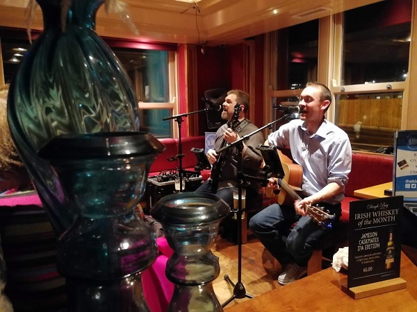
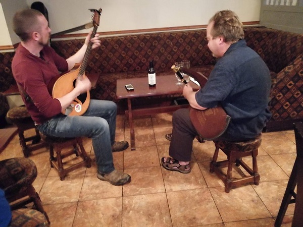
There were a couple of Irish Musicians tuning up with guitar and fiddle but, from their equipment and voices, it was obvious that they were not casual amateurs. The ballads were introduced with genial familiarity with their significance often described to the appreciative diners. It was with reluctance that I eventually left.
Today was Day 28 when I hoped to reach my goal. The forecast was not good; it would soon start to rain and then become increasingly heavy. I looked out and it was another one of those Irish Mist mornings. Had a splendid, filling breakfast in preparation for the day with the slice of Irish soda bread which comes with almost every meal (though I think you need to be Irish to enjoy it). The reviews for de Morda had also been enthusiastic about Angela’s packed lunch.
Before I started the tour, I had thought very carefully about what rainproof gear to wear. It needed to be as light as possible but protect me from all weathers. Waterproof cycling jackets work well for cycling but not for walking around in heavy rain so I had bought a top-of-the-range Gore-tex jacket which has a waterproof breathable membrane and had worked exactly as promised, never letting wet in, or getting me sweaty. It was very light and also worked well when cycling and I would need it today.
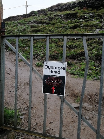
I put the packed lunch in a plastic bag with my light binoculars and the large scale map for the area. The gate to Dunmore Head is less than 2 miles from de Mordha but as I started walking up the road it started to rain. Dunmore Head is, at first, dome like, then westward turns into a ridge descending to the sea with a line of three rocks in the sea.
There is a small gate where you are invited to make a contribution of €1, a bit cheaper than Lands End in Cornwall. There is another small notice to say that part of Stars Wars had been filmed there.
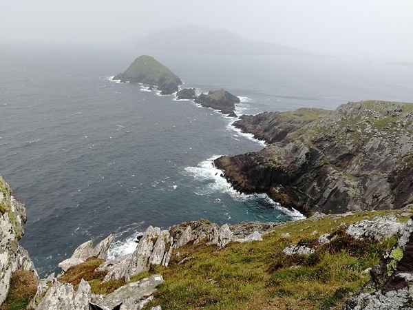
The pathway up the side was very rough and dramatic as it ran along the top of the cliff, with normally grand views along the coast but now with waves sweeping on the sandy cove below. I was getting exposed to an increasingly strong wind and heavier rain but carried on. After some time I rounded the hill and was able to work out where the mainland ended and took a photo. The headland loses height, becoming narrower until there is a narrow channel of sea between it and three off-shore islands. From the distance there was no indication that the end was marked but the channel was clearly where the mainland finished.
You can just see the channel
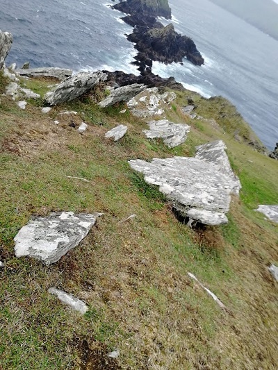
I rounded the bluff near the top and was immediately hit by very strong gusts hurtling around it, the same sort of effect that you get around tall buildings. The rain seemed even heavier and I edged cautiously downwards as it became increasingly steep and rocky. I could see most of the way now but it looked very difficult to get all the way down to the channel. I inched along, holding on to rocks or the grass, when a particularly heavy gust whistled by knocking me down so I decided this was my “ Lands End” and took a photo. I had started to head back when a young couple, the only
people I had seen on the top so far, passed rather more confidently. I was rather pleased to see, however, that their “Lands End” was not much further down than mine.
My most westerly point
The Blasket Islands were much nearer and I tried out the binoculars to see if I could spot the seals which used the beaches there. I thought I could see some grey forms on the beach but it was not clear enough to be certain. The visibility was being reduced by the even heavier rain.
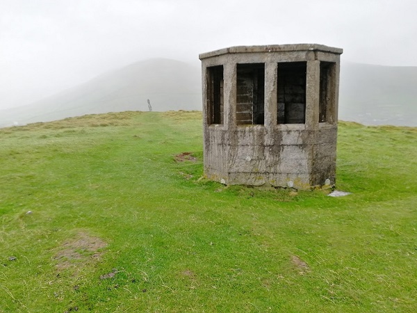
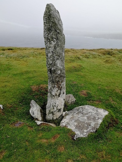
I headed up to the top to seek the shelter of a small observation post erected there in the war and was able to go inside to eat the packed lunch and warm up. I tried to take some photos but now had the same problem that I had had at the loch at Anascaul when my finger and the mobile were too wet to unlock it . A short distance further was an erect stone which was one of a number of Ogham Stones placed in prominent situations in the Peninsular.
Ogham Stones are so called because they have inscriptions in Ogham, the primitive Irish language first used in about the fourth century, which consists of a combination of straight lines carved on the rock. They usually commemorate someone and this one was known as the Coumeenoole Ogham Stone which commemorated Erc (Eric) but also mentioned Dovina so it was possibly a place of ritual worship to the fertility goddess Duibhe (Dovinnias). I was determined to get a photograph and eventually did as the rain was not falling so heavily.
I could then see that there was a quicker way to the exit by crossing the dome, although I did not spot that the heather hid some rocky hollows so I came a cropper a couple of times and collected a few spines in my hands. I soon reached the road and noticed on the way back that the cafe was still open, so I had a warming cup of coffee and some food.
On arriving back at the B & B, when Angela opened the door she said instantly “get all those wet clothes off and give them to me and I will put them in the dryer”. Much later, after I returned, two separate groups of walkers arrived and each was greeted by the
same great welcome as I had by Angela when I first arrived and an immediate invitation to hand her their wet clothes. Both groups had both been walking around the Peninsula on the coastal path shown on the maps as Sli Chorca Dhuibhne (The Dingle Way). One group was German, the other American/Canadian. Speaking to them later, both said what a hard day it had been, rocky and exposed and they had only been able to travel slowly. They took a taxi to Ballyferriter for their evening meal.
Michael recommended Murphys pub/restaurant and it was in the same style as the others I have enjoyed: predominantly brown furnishings, bar along one side with scattered tables and chairs, groups of families or friends in a relaxed social club atmosphere.
A pair of musicians arrived, one with a fiddle, the other with Uilleann pipes. The tone of the pipes, essentially a small bagpipe, combined well with the lively fiddle and it was possible to talk or sing at the same time as playing them. They would chat, practice and play mostly reels and jigs to the approval of other customers. Large plates of food were brought and I gained the impression that they would be livening up the evening later.
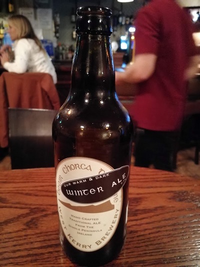
I had bought myself a draft beer and then spotted a long list of bottled beers hanging up behind the bar. They were from at least 6 different Kerry breweries. I always like trying local beers and keep my eyes open for them on draught but had not realised about the bottles until the barman, who enjoyed talking about the subject, told me that the numerous local microbreweries supplied bottles, rather than draught. A missed opportunity, perhaps, but I had found that most places had a Kerry beer on draught. I spotted a winter ale on the list, the first I had seen this year, and ordered it as a harbinger of warm beer in front of a country pub’s log fire. The winter ale was from the West Kerry Brewery and it was scrumptious!
I fancied staying longer and before the trip I had imagined long nights in an Irish pub enjoying the music and atmosphere but, as usual, the large meal and couple of beers made bed seem more attractive and I ordered a taxi back. It was too dark to see much but the taxi driver was good company as usual.
Awoke to bright sunshine though it did not last and there were occasional showers during the day which by now I was becoming used to.
Breakfast was included: breakfast type food was put into the fridge and cereals left out on the counter by the Warden and there was also some unused food left in the fridge. We could use anything left there but were warned to check the date. I had brought some cereal and milk which was fortunate as the supply was running low.
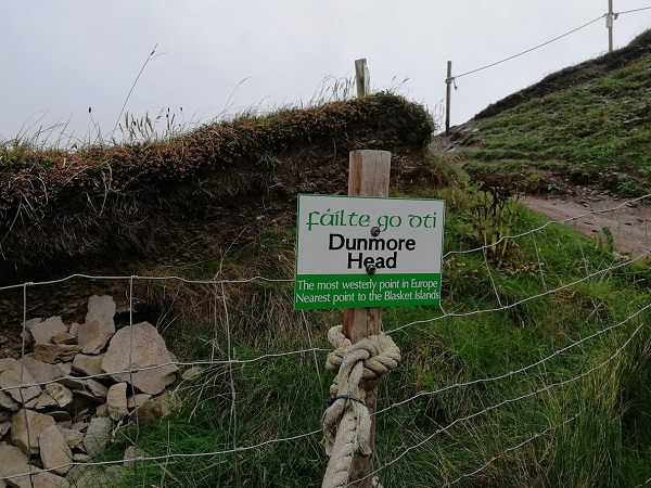
Retrieved my bike from the shed to set out on what looked as if it may be a really special day because of the historic sites along the way. Firstly there was a 6 mile ride to Dingle, another popular tourist centre, along what looked as if it would be a hilly ride with even more spectacular views. I would then be heading west along the Slea Head Drive, part of the Wild Atlantic Way, to pass near my final target at Dunmore Head that I have been describing as the most westernmost point on mainland Ireland, but which the tourist brochures usually described as the most westerly point in mainland Europe or the nearest point in Europe to the USA.
The road from Annascaul to Dingle was a National Route from Tralee to Dingle which was in good condition and being upgraded in places which included a bicycle path separated from the roadway.
During a grind uphill I stopped at a lay-by and took a photograph of the views, although,
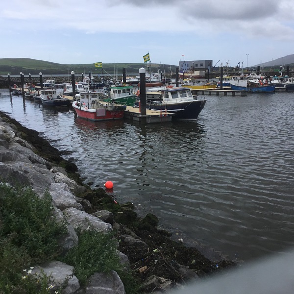
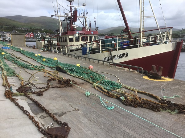
unfortunately, my phone camera cannot focus to show the dramatic effect of the distant hills. Soon after I started a long freewheel down to Dingle Harbour. There was a large marina separated from the commercial and fishing harbour where I could see Kerry flags flying . The Atlantic Fisher had its nets out to dry. I also took a photo of a stern trawler with its nets in position for launching.
Kerry flags
Dingle itself was smaller than I expected with narrow picturesque streets and lots of places to eat and buy Irish themed presents. In Killarney it had been advertised as one of the main tourist destinations and many tourist coaches stopped there and returned by heading northeast across the mountains on the famous Connor Pass with a splendid viewpoint at the summit after a climb of 500 metres. For a cyclist, the climb from the north coast of the Peninsular was probably the most famous unrelenting climb in Ireland, and I had been urged by cycling friends to try it but, perhaps fortunately, I was not heading that way.
After a sandwich, Coke and fruit, I headed along the now narrower coast road through the earliest inhabited part of Ireland. The oldest settlement is Mesolithic at Ferriter’s Cove, which I would be passing close to another day, and was dated by cattle bones to around c3540 B.C. Signs appeared regularly showing the way to historical sites. My problem was that there were rough paths to them which were too difficult to push my bike along and I did not fancy leaving the bike and panniers out of sight for long. What I would normally do, if I was leaving my bike, would be to make sure that I had secured the bicycle to some solid structure, put all my valuables in a small pannier to take with me and make sure I was not out of sight of the bike except for the shortest possible time.
Hut sites
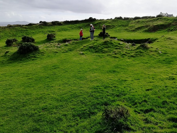
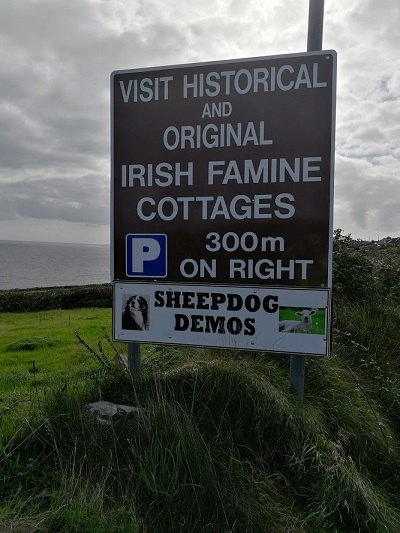
I was lucky as the first sign I saw was to a Celtic Period Iron Age enclosure close to the road where I could keep an eye on the bike secured in the small car park. The guide was showing a couple the defensive ring ditches around the perimeter and the foundations of huts within. The huts were all made of stone laid in a sloping manner so the rain would run off them. Further along the road there were signs to “Beehive Huts” because of their shape which solved the problem of having a roof made of stone. Later I was able to look down at the Dun Beg Fort, an elaborate Iron Age ring fort, now steadily crumbling down the cliffs into Dingle Bay. There had been several forts which had been built as a defence against Viking raids. There were also several signs to “Famine Cottages”, abandoned in the 1840s, the time of “The Great Famine”, as the potato crop failed year after year and a million people starved to death and as many emigrated to America or England. There were fewer coaches, and most of the tourists were now in motor cars; the parking was usually limited but fortunately there were a lot of historic sites.
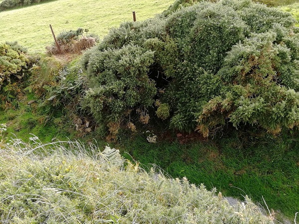
Perimeter Ditch
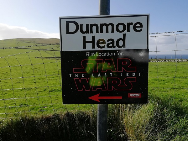
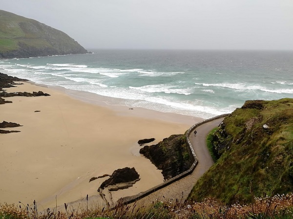
After the fort there was a long climb to Slea Head where the narrow road crawled round under a vertical face, turned north and downhill to Dunmore Head where there was a notice that it had been a film location for Star Wars, Return of the Jedi. and where I would be tomorrow walking to the most westerly point. I was anxious to find out whether there was somewhere I could safely leave my bike and there was a road down to a sandy bay but no safe place there so I set off to De Mordha Bed and Breakfast after one of my most interesting 30 mile cycle rides ever.
Just as I was approaching the outskirts of the village of Dunquin, (Dun Choain in Gaelic, the name used locally) there was a sign to what proved to be a very different-to-the-usual gift shop. You first entered a room absolutely packed with books, mostly related to the local area, particularly the Great Blasket Island or Celtic history, including one co-authored by Micheal De Morda, which took my attention as I was heading to the De Mordha Bed and Breakfast. There were also high quality gifts mostly related to the local area or Celtic history and you then passed though to a large cafe which could accommodate a coach party. It was 5pm and the cafe had just closed but I discovered De Mordha a few hundred yards further on.
Of all the reviews I had read when searching for places to stay during the tour, none had so many praising their establishment than De Mordha and particularly the welcome from, and helpfulness of, Angela the proprietor and the interesting conversations with her husband, Michael. Reviews came from visitors from all over the world. The welcome I immediately experienced and settled myself in a very comfortable room next to the front door. The visitors’ lounge was large with information and books about the local area, including some by Micheal, and a splendid view over the bay. I could hear Angela and her husband talking in the kitchen and realised that they spoke in Gaelic if no residents were around.
There was then the problem of the evening meal. Once the cafe had closed, the nearest place to find food was Ballyferriter about a 15 minutes drive away. What often happened was that the residents would get together and hire a taxi but it eventually became clear that that night I was the only person needing one. Michael then offered to run me over there. I was very grateful and there followed my most interesting 15 minutes of the whole trip. He said that at 17 he had gone away to Dublin to be a reporter and many years later had joined a Gaelic radio station as producer, but presenting as well.
On the way he pointed out the hills where part of Ryan’s Daughter had been filmed. A village had been built for the film and was to be demolished in a storm as part of the plot but, surprisingly, they had to wait for a year for a good enough storm. It was a British film but Robert Mitchum was given a starring role. (Alec Guinness had turned it down), John Mills and his daughter Sarah both won Academy Awards, Sarah as best actress in a leading role and John as best actor in a supporting role. Michael said that the film company became like the local government while they were there: they paid to the locals the wages they paid the rest of the firm employees which were far greater than farm workers could earn so when they left after the year it enabled many of them to buy a tractor.
Michael also pointed out Blasket Sound, where the Santa Maria de la Rosa and San Juan ships of the Spanish Armada were shipwrecked in 1588 and also some mysterious looking rocky peaks where part of Star Wars had been filmed.
The further west you go along the Dingle Peninsular, the more Celtic it becomes and the Gaelic language takes over. Almost all place names have a Gaelic alternative but, increasingly, some like my B & B were just Gaelic, and notices or explanation boards would be Gaelic first and “English” second.
Today was my spare day, earned by my speedy crossing of Ireland, so I planned to use it by exploring the hills. One problem had been that Teac Seain B & B only had a vacancy for one night but I had found a vacancy at the Dingle Gate Hostel two miles down the road.
Looking up the weather forecast the previous night it had not seemed promising: light rain from after 9am which turned into heavy rain, a slight remission in the middle of the day then heavy rain again, clearing later in the afternoon. When I peered around the curtains on waking I could see that there was the traditional Irish Mist with very poor visibility. Strangely, it does not seem to be raining but it immediately condenses on you once you start moving and without protection you are soon soaking. I went down for my usual breakfast, loads of cereals, toast, lots of orange juice and coffee and anything else laid out which looked interesting. Here, it was a large individual bowl of yogurt with lots of different fresh fruit and cream. By the time I had packed my panniers and was
ready to go the rain had really set in and the hostel was not open until 3pm.
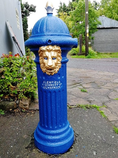
I discussed my predicament with Kate, the proprietor, who was instantly very sympathetic. She would need the room but suggested that I left my bike in a hallway accessible from the outside and told me of a friendly little cafe along the street. I bought a newspaper in the village shop, ordered a coffee in the cafe and settled down to wait. The only other customers were a couple who had clearly also settled in for a long stay. I tried, unsuccessfully, to send by phone a photograph of what I assumed was a hydrant, to my friend Jim MacTaggart, a friend and very experienced touring cyclist from Kilmarnock in Scotland.. He has cycled across the USA three times, once with his wife Cathy, and it was he who had advised me on my choice of bike for the trip.
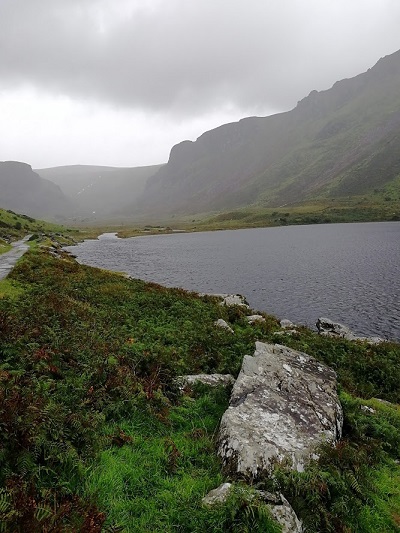
The rain seemed to be easing slightly so I went back and collected my bike. Kate (and others) had told me I must not miss seeing the views at Lough Annascaul in the hills above Annascaul, accessible by a narrow lane which climbed up from the main street. I flew up, no panniers, a following wind and extra strength from a month’s touring. The views were magnificent. By now I had another photography problem, which I had met on another wet day in Wales, in that there was great difficulty in taking photographs in bad weather. It had now started raining heavily again, and to unlock the phone I had to have a dry finger and, even if I managed to get it open, if any wet touched the
screen when I was taking a photograph it would not work. I was determined to get a photograph, both up and down the high valley from the loch. The technique was to plunge my finger into my clothes until I found a dry garment, dry the finger and, with the phone as ready as possible, try to shelter it enough to take a photo quickly. After about 10 minutes I succeeded, though now I had much wetter underclothes!
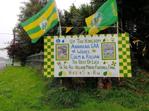
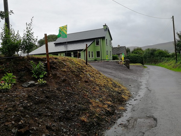
Throughout the village there had been notices and flags about two locals, Colm and Killian, who had been in a competition and I was able to photograph a couple of the signs the next day. They were all in the yellow and green, the colours of Kerry, and, as I had rode up the lane, they had been more splendid and frequent until there was a large flag outside a green farmhouse with detailing in yellow. Speeding back down the lane the rain almost seemed solid but I stopped and, with even more difficulty, managed to get a photo of the flag. Before I could set off, a tractor drew up, and the driver told me it was Gaelic Football and the previous weekend Kerry had won the All Ireland Minor Football Final with the two players from Annascaul in the team. I found out that it was for under 18s and there were 31 county teams. Kerry had defeated Galway 0-21 to Galway’s 1-14 to claim their fifth All Ireland title in a row, the first time this feat has been achieved. A team of the year was chosen, taken from all the competitors in the finals, and this included Colm. Killian had hit 4 points in the final and chosen as Man of the Match.
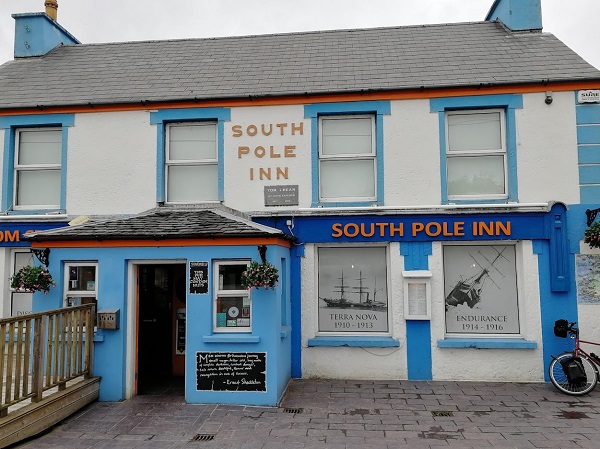
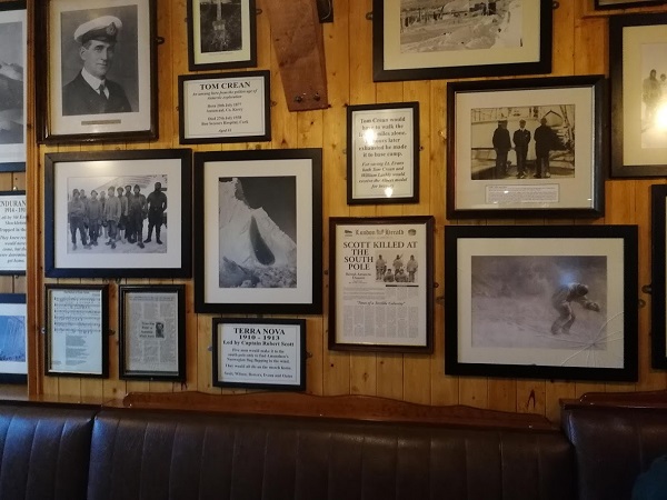
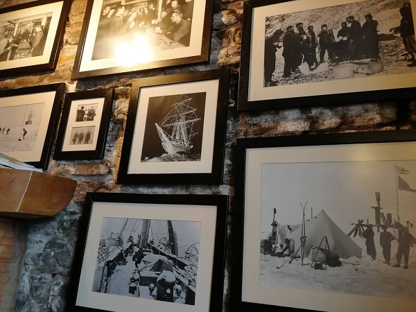
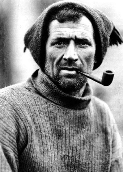
As soon as I returned to the main street, I headed into the South Pole Inn and managed to find a very quiet corner, order a pint of local beer and started stripping off layers and putting as many of my wet clothes as was decent in a pile hidden against the corner wall so I could begin warming up. It was getting towards 1pm and I ideally wanted to stay there until as near 3pm as possible. It was a big pub and every inch of the wall was covered with items about Tom Crean including many original photos and artifacts, all
of which I examined slowly and carefully; the pub was like a museum.
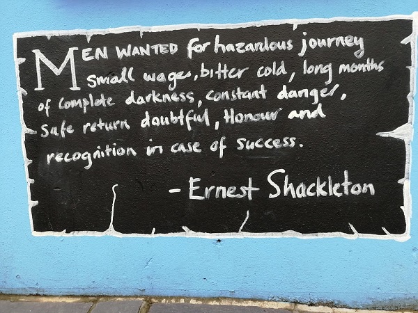
Tom was born in 1877 and had left school at 14, joined the Navy at 15 and, at 24, he volunteered to join Scott’s fatal expedition to the South Pole. During the expedition, his 35 mile walk across the Ross Ice Shelf to save the life of Edward Evans resulted in his being awarded the Albert Medal. He is probably most famous for Shackleton’s “Endurance” expedition, a copy of the request for volunteers I had seen the previous night outside the Inn. The centenary had given rise to a new book, films, TV series, and a large exhibition of the original equipment including the lifeboat. Shackleton had appointed Tom as Second Officer. The Endurance was crushed by a sudden movement of the ice and they dragged the food, gear and three lifeboats for 200 miles across the pack ice and then sailed and rowed the boats for 5 days to Elephant Island hoping for rescue.
Shackleton decided, instead of continuing to wait, to sail a lifeboat the 800 miles to South Georgia. After what was described as one of the most extraordinary feats of navigation and seamanship, and through gales and snow squalls, they arrived on the 10th May 1916 at the island’s uninhabited south coast. With the boat having been damaged and some of the crew unfit to travel, Shackleton decided that the three fittest, himself, Crean and Worsley. should try to cross the 30 miles across the hilly, glaciated surface to a whaling station. It was the first recorded crossing of the mountainous island.
Tom returned to the Navy and, the next year, married Ellen Herlihy of Annascaul. He retired in 1920 and he and Ellen bought the public house which he renamed the South Pole Inn and they had three children. He died in 1938 following a burst appendix.
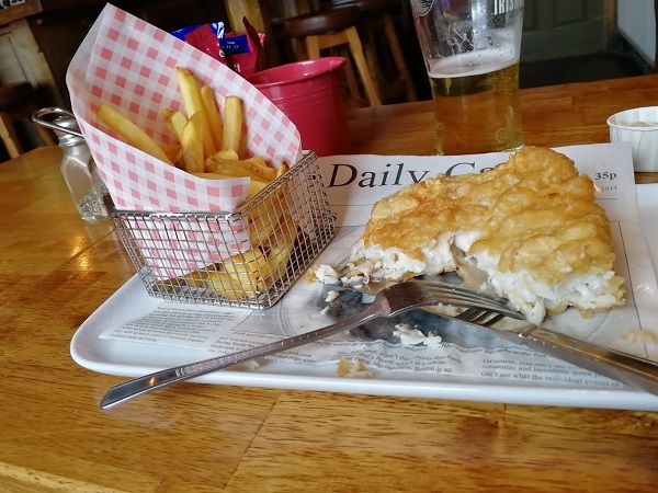
Although I had not been pressed to order, eventually I ordered fish and chips which was delivered with probably the largest piece of fish I have had with such a meal. Collecting my bike I bought some food for my evening meal later at the hostel where I had booked a room rather than a place in the dormitory. The warden was cheerily informal, seemingly to start almost all his sentences to everyone with an upbeat “that’s no problem” including when it was discovered that I had paid for a room rather than a place in the dormitory. He quickly made up a room which was comfortable, and I later chatted with some of the other guests in the common room/kitchen. The opportunity to meet a variety of people makes hostels popular.
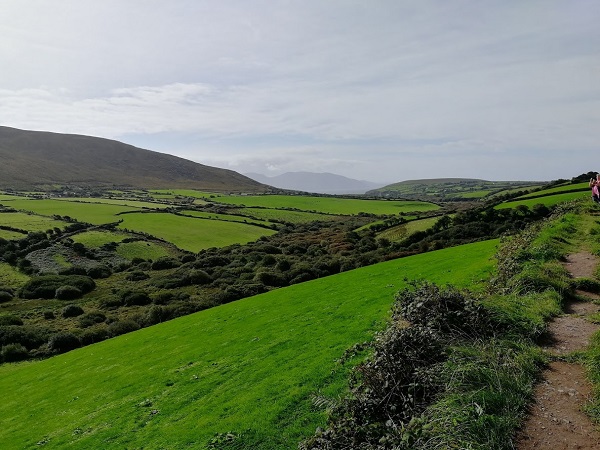
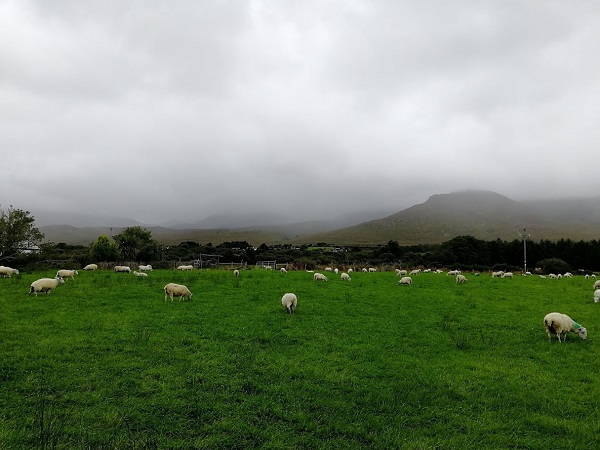
The trip was now about to take a different turn, literally. From Killarney I would be taking the R536 northwest across an undulating pastoral landscape until I met the N70 again and, in less than two miles at Castlemaine, would turn west along the Dingle Peninsular until its end. Today I would see the end of fields full of cows, although I could now expect to see sheep on the slopes.
The peninsular consists of a string of mountains along its spine with three crossings to the road following the north coast. The Visitors’ Guide to the Dingle Peninsular says that there is no other landscape in Western Europe with the density and variety of archaeological monuments as the peninsula which has supported tribes and populations for almost 6,000 years. Moreover, because of its remote location and the lack of specialised agriculture, there is a remarkable preservation of over 2,000 monuments.
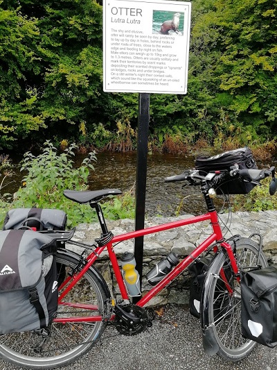
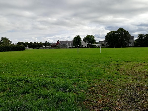
Heading out of town I saw the magnificent Cathedral on one side and on the other was the National Park and a stream running parallel with the road. Saw a notice by the stream about otters; the stream was crystal clear. The slightly peculiar goalposts in a sports field were for Gaelic football and schools I passed often had a set.
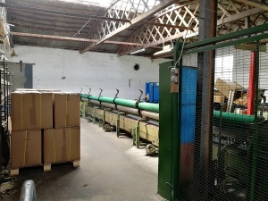
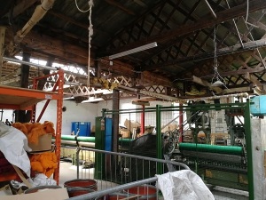
Turned off the main road to follow the country road to the N70 and, after a few miles, saw a sign down a road to the Kerry Woollen Mills: kerrywoollenmills.ie These mills were much larger than those I had visited in Wales as in the weaving shed two sets of cloth were being woven one on a very long loom. There was a large shop which had an extensive display ranging from very expensive Kerry Merino Wool blankets at over £100 to some attractive small presents for the less well-heeled tourists.
Soon I was at Castlemaine, by the side of the road, and approaching the turn there was a very large notice warning coaches, caravans and other large vehicles that they must follow the road around the peninsular in a clockwise direction only as there was not room to pass similar vehicles coming the other way on the narrow road. This sounded interesting so headed down the road with increasing anticipation. With the Slieve Mish Mountains mostly covered with threatening clouds on my right, and a wide view over the water on my left, the nature of the ride had suddenly changed.
I had noticed in the travel agents in Killarney that a lot of trips to Dingle and the peninsular were advertised, and, indeed, increasing numbers of coaches started coming up behind me. At first they were mainly from Killarney but, as the day advanced, they were coming from places further away. They were an irritation but not as much an irritation as I was to them when I struggled slowly up a hill and they could not find a clear stretch to overtake me.
As the road climbed, it narrowed but occasionally a lay-by had been created where there was a particularly scenic view so that vehicles, including coaches, could stop and the passengers could get out to take photos. “We have five minutes,”one observed grumpily as they were being hustled back into the coach and, though it seemed to me it had been a generous five minutes, I could understand the reluctance to return to the coach as the views over Dingle Bay to the mountains beyond were now becoming breathtaking.
As I was about to move away from a lay-by, a car drew up and I was hailed by a familiar
Canadian voice: it was the Canadians from Murphy’s Bar that were driving the Wild Atlantic Way. This route starts from Cork and follows the west coast. I had been told a number of times how spectacular it was when planning my trip, including by Ita’s brother who had been in a group following much of it. The Canadians had been unlucky the previous day as they had been going around the Iveragh Peninsula, perhaps the most spectacular section of the Way and route of the Ring of Kerry, but the rain and mist meant they had seen little of it. I took their photographs on their cameras and we took our cheery leave not expecting to see each other again but when I arrived at the next viewpoint they were just leaving so we said a more cautious goodbye this time!
Now all the hedgerow flowers I had been seeing crossing Ireland had gone and were replaced on the roadside banks by heathland. The coast had been rocky for some miles but eventually I reached a lane leading down to the bay at Inch. It has a renowned sandy beach along a headland and a centre for surfing and there were some surfers with old VW vans just packing up and, as it was now starting to rain and it seemed a long time since breakfast, I went inside the Tourist Centre for a ham and cheese panini. There was a large cafe with an even larger bar and games room. It was designed to have enough room for coach parties. There had been no places to stop except at the view points since Castlemaine so its toilets must have also been very welcome. When I left I took a photograph of the, now wet and deserted, beach with the mountains of the Iveragh Peninsular in the distance.
From here it was a wet and hilly ride to Anascaul where I was staying at the Teac Seain B & B. It had been a hard few miles. On my way into the village I had passed the South Pole Inn with an intriguing notice outside. Tom Crean, the Antarctic Explorer who had been with Shackleton on his Discovery Expedition in 1901 and the Endurance Expedition which set off in 1914, had bought the Inn on his retirement. I went there, as recommended, for a meal, walking down a cold, dark, windy street into the warm packed Inn buzzing with conversation and laughter where I managed to find a corner to have a hearty meal over which I took my time before returning to the B & B to go straight to bed.
Tom Crean
All the walls of the Inn had been covered with old photographs, notices and memorabilia which, as the nearby tables were occupied, were impossible to look at so I was determined to return next day to discover more.
When I mentioned to Irish friends that I was intended to go to the West of Ireland, I was told I must visit Killarney, and when I began crossing Ireland and told people of my plans the more that recommendation became insistent. It was sometimes added that there were a lot of American visitors and it was very touristy. Wikipedia mentions that 200 years of tourism were celebrated in 1947, also that the railway arrived in 1841 and Queen Victoria visited in 1861.
The previous evening I was very strongly recommended to go to Murphy’s Bar in College Street which described itself accurately as combining tradition and hospitality with its long bar, many Irish artifacts and mixed sized tables for groups. It was heaving but, as I was by myself, I was able to eat at a counter. Not surprisingly, the food was good and the portions large. I had a Thai Green Curry and it was not the overcooked mush you can sometimes get with this recipe, but with vegetables al dente and the spices perfect. The Irish music added to the atmosphere. Next to me was a table of American tourists who were swapping tales of the good time they were having there. They were not the brash
tourists you sometimes meet in capital cities but were really enjoying what Killarney and the Dingle Peninsular had to offer.
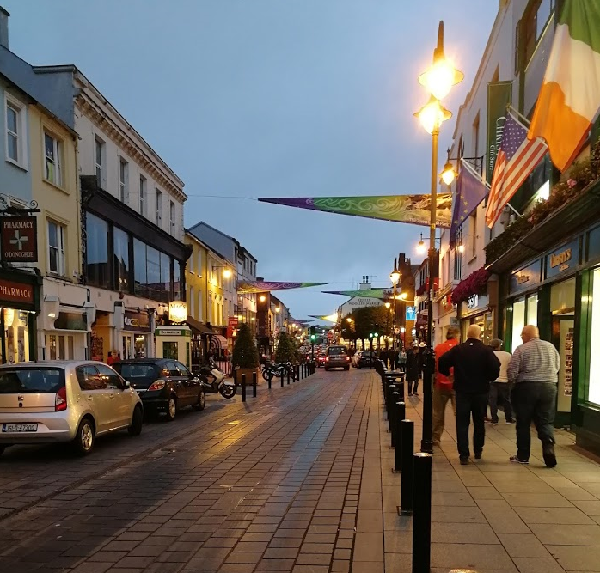
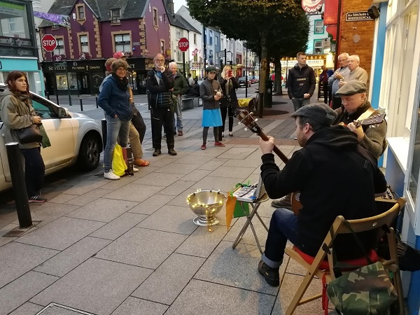
Afterwards, I wandered round the town centre and it was still busy, brightly lit, most of the shops were still open, and there were street musicians playing reels and ballads.
Next morning I was up late and I had started to look forward to the rest day. As in Wales my legs had quickly settled into the cycling, but because I had kept stopping to look at so many interesting things on the way I tended to arrive late, go out for a leisurely meal and a beer and then hit the sack. A leisurely morning sounded attractive and I had planning to do.
From the beginning I had been concerned about the next stage. The obvious place to stay was Dingle. It was a stage of about 36 miles along the Ring of Kerry though some of it ran along the coast and it seemed that some could be very hilly. Before I set out I had not been sure how far I could reasonably do in a day with full panniers and was worried about reaching Killarney on the day I’d planned. It had been a needless concern so I now had the extra day in hand which could be used in exploring the Dingle Peninsular. However, I found that the delay in making the decision had meant that there was hardly any accommodation available in Dingle and what there was, was very expensive. There was little accommodation on the way to Dingle either but I was fortunate to book at the Teac Seain Inn at Annascaul for one night, and the Dingle Gate Hostel a couple of miles away for the next night and booked the Hide Out Hostel in Dingle for the way back.
I also did a little of the blog and then went out to explore Killarney in the daylight and returned to Murphy’s for an evening meal where I had a long interesting chat with two Canadians.They were following the Wild Atlantic Way which covers the rugged West Coast from Cork to Derry.
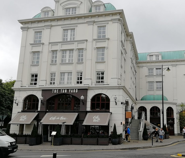
Killarney was like no other place in Ireland. I had seen in Wikipedia that in the 19th and 20th centuries it had become an international tourist centre with grand hotels and there were many historic sites in Kerry and on the peninsula to visit including Lough Leane and The Killarney National Park, close by the town itself. The first big hotel I came across was The Tan Yard, with Parisian touches. The Tourism Office proudly proclaimed that Trivago had voted the Killarney hotels the best in the world in 2016. Many coach tours were being advertised and the most popular seemed to be around the Peninsular for the views and prehistoric sites. This was where I was going.
![stenaferry[2305843009214797506]](https://westandfurthestwest.files.wordpress.com/2019/03/stenaferry2305843009214797506.jpg?w=1100)