Awoke to bright sunshine though it did not last and there were occasional showers during the day which by now I was becoming used to.
Breakfast was included: breakfast type food was put into the fridge and cereals left out on the counter by the Warden and there was also some unused food left in the fridge. We could use anything left there but were warned to check the date. I had brought some cereal and milk which was fortunate as the supply was running low.
Retrieved my bike from the shed to set out on what looked as if it may be a really special day because of the historic sites along the way. Firstly there was a 6 mile ride to Dingle, another popular tourist centre, along what looked as if it would be a hilly ride with even more spectacular views. I would then be heading west along the Slea Head Drive, part of the Wild Atlantic Way, to pass near my final target at Dunmore Head that I have been describing as the most westernmost point on mainland Ireland, but which the tourist brochures usually described as the most westerly point in mainland Europe or the nearest point in Europe to the USA.
The road from Annascaul to Dingle was a National Route from Tralee to Dingle which was in good condition and being upgraded in places which included a bicycle path separated from the roadway.
During a grind uphill I stopped at a lay-by and took a photograph of the views, although,
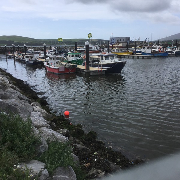
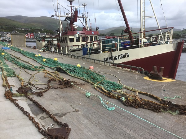
unfortunately, my phone camera cannot focus to show the dramatic effect of the distant hills. Soon after I started a long freewheel down to Dingle Harbour. There was a large marina separated from the commercial and fishing harbour where I could see Kerry flags flying . The Atlantic Fisher had its nets out to dry. I also took a photo of a stern trawler with its nets in position for launching.
Dingle itself was smaller than I expected with narrow picturesque streets and lots of places to eat and buy Irish themed presents. In Killarney it had been advertised as one of the main tourist destinations and many tourist coaches stopped there and returned by heading northeast across the mountains on the famous Connor Pass with a splendid viewpoint at the summit after a climb of 500 metres. For a cyclist, the climb from the north coast of the Peninsular was probably the most famous unrelenting climb in Ireland, and I had been urged by cycling friends to try it but, perhaps fortunately, I was not heading that way.
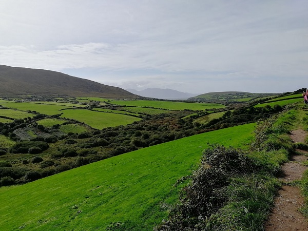
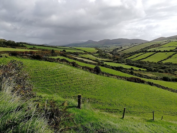
After a sandwich, Coke and fruit, I headed along the now narrower coast road through the earliest inhabited part of Ireland. The oldest settlement is Mesolithic at Ferriter’s Cove, which I would be passing close to another day, and was dated by cattle bones to around c3540 B.C. Signs appeared regularly showing the way to historical sites. My problem was that there were rough paths to them which were too difficult to push my bike along and I did not fancy leaving the bike and panniers out of sight for long. What I would normally do, if I was leaving my bike, would be to make sure that I had secured the bicycle to some solid structure, put all my valuables in a small pannier to take with me and make sure I was not out of sight of the bike except for the shortest possible time.
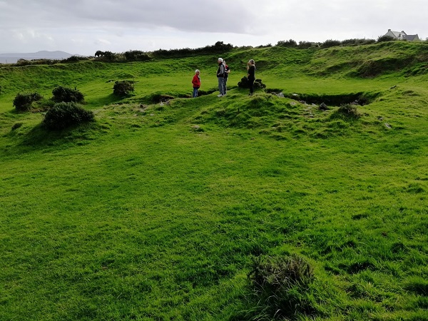
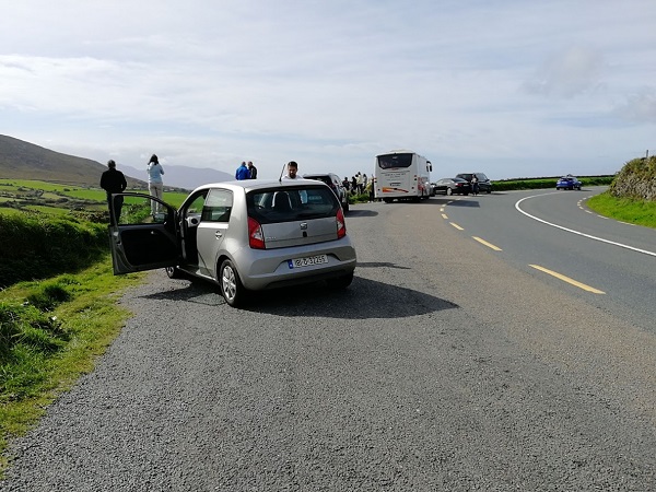
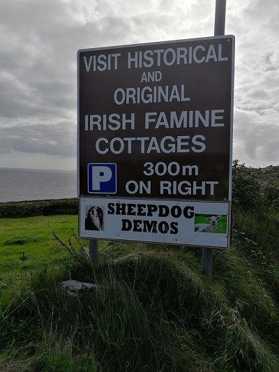
I was lucky as the first sign I saw was to a Celtic Period Iron Age enclosure close to the road where I could keep an eye on the bike secured in the small car park. The guide was showing a couple the defensive ring ditches around the perimeter and the foundations of huts within. The huts were all made of stone laid in a sloping manner so the rain would run off them. Further along the road there were signs to “Beehive Huts” because of their shape which solved the problem of having a roof made of stone. Later I was able to look down at the Dun Beg Fort, an elaborate Iron Age ring fort, now steadily crumbling down the cliffs into Dingle Bay. There had been several forts which had been built as a defence against Viking raids. There were also several signs to “Famine Cottages”, abandoned in the 1840s, the time of “The Great Famine”, as the potato crop failed year after year and a million people starved to death and as many emigrated to America or England. There were fewer coaches, and most of the tourists were now in motor cars; the parking was usually limited but fortunately there were a lot of historic sites.
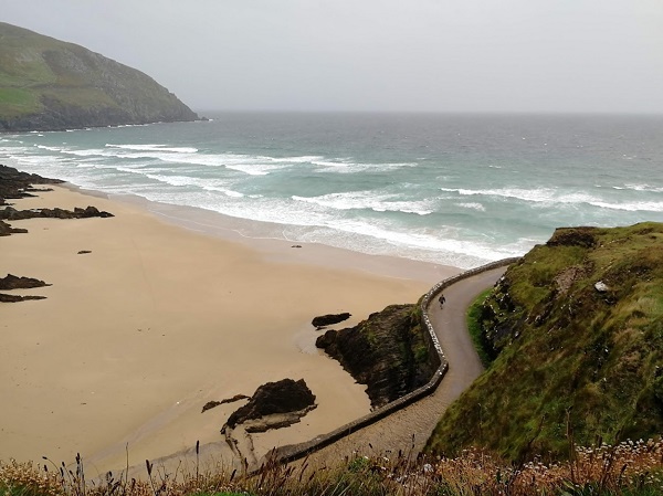
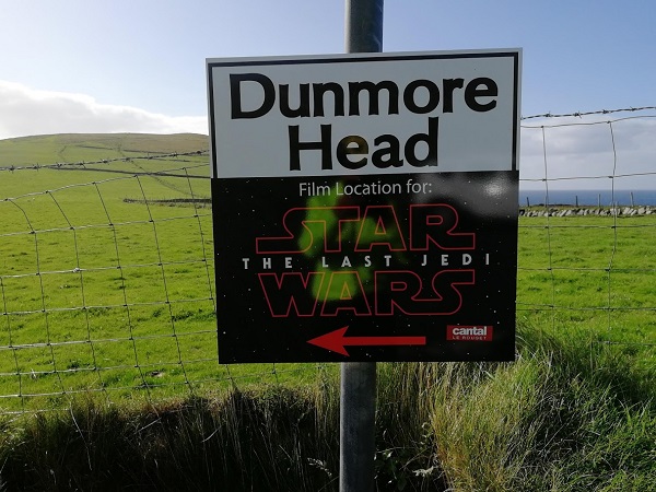
After the fort there was a long climb to Slea Head where the narrow road crawled round under a vertical face, turned north and downhill to Dunmore Head where there was a notice that it had been a film location for Star Wars, Return of the Jedi. and where I would be tomorrow walking to the most westerly point. I was anxious to find out whether there was somewhere I could safely leave my bike and there was a road down to a sandy bay but no safe place there so I set off to De Mordha Bed and Breakfast after one of my most interesting 30 mile cycle rides ever.
Just as I was approaching the outskirts of the village of Dunquin, (Dun Choain in Gaelic, the name used locally) there was a sign to what proved to be a very different-to-the-usual gift shop. You first entered a room absolutely packed with books, mostly related to the local area, particularly the Great Blasket Island or Celtic history, including one co-authored by Micheal De Morda, which took my attention as I was heading to the De Mordha Bed and Breakfast. There were also high quality gifts mostly related to the local area or Celtic history and you then passed though to a large cafe which could accommodate a coach party. It was 5pm and the cafe had just closed but I discovered De Mordha a few hundred yards further on.
Of all the reviews I had read when searching for places to stay during the tour, none had so many praising their establishment than De Mordha and particularly the welcome from, and helpfulness of, Angela the proprietor and the interesting conversations with her husband, Michael. Reviews came from visitors from all over the world. The welcome I immediately experienced and settled myself in a very comfortable room next to the front door. The visitors’ lounge was large with information and books about the local area, including some by Micheal, and a splendid view over the bay. I could hear Angela and her husband talking in the kitchen and realised that they spoke in Gaelic if no residents were around.
There was then the problem of the evening meal. Once the cafe had closed, the nearest place to find food was Ballyferriter about a 15 minutes drive away. What often happened was that the residents would get together and hire a taxi but it eventually became clear that that night I was the only person needing one. Michael then offered to run me over there. I was very grateful and there followed my most interesting 15 minutes of the whole trip. He said that at 17 he had gone away to Dublin to be a reporter and many years later had joined a Gaelic radio station as producer, but presenting as well.
On the way he pointed out the hills where part of Ryan’s Daughter had been filmed. A village had been built for the film and was to be demolished in a storm as part of the plot but, surprisingly, they had to wait for a year for a good enough storm. It was a British film but Robert Mitchum was given a starring role. (Alec Guinness had turned it down), John Mills and his daughter Sarah both won Academy Awards, Sarah as best actress in a leading role and John as best actor in a supporting role. Michael said that the film company became like the local government while they were there: they paid to the locals the wages they paid the rest of the firm employees which were far greater than farm workers could earn so when they left after the year it enabled many of them to buy a tractor.
Michael also pointed out Blasket Sound, where the Santa Maria de la Rosa and San Juan ships of the Spanish Armada were shipwrecked in 1588 and also some mysterious looking rocky peaks where part of Star Wars had been filmed.